
Fortæl dine venner om denne vare:
Family Maps of Newton County, Missouri
Gregory A. Boyd J.d.
Bestilles fra fjernlager

Family Maps of Newton County, Missouri
Gregory A. Boyd J.d.
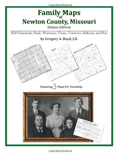
234 pages with 77 total maps Locating original landowners in maps has never been an easy task-until now. This volume in the Family Maps series contains newly created maps of original landowners (patent maps) in what is now Newton County, Missouri, gleaned from the indexes of the U. S. Bureau of Land Management. But it offers much more than that. For each township in the county, there are two additional maps accompanying the patent map: a road map and a map showing waterways, railroads, and both modern and many historical city-centers and cemeteries. Included are indexes to help you locate what you are looking for, whether you know a person's name, a last name, a place-name, or a cemetery. The combination of maps and indexes are designed to aid researchers of American history or genealogy to explore frontier neighborhoods, examine family migrations, locate hard-to-find cemeteries and towns, as well as locate land based on legal descriptions found in old documents or deeds. The patent-maps are essentially plat maps but instead of depicting owners for a particular year, these maps show original landowners, no matter when the transfer from the federal government was completed. Dates of patents typically begin near the time of statehood and run into the early 1900s. What's Mapped in this book (that you'll not likely find elsewhere) . . . 2104 Parcels of Land (with original landowner names and patent-dates labeled in the relevant map) 44 Cemeteries plus . . . Roads, and existing Rivers, Creeks, Streams, Railroads, and Small-towns (including some historical), etc. What YEARS are these maps for? Here are the counts for parcels of land mapped, by the decade in which the corresponding land patents were issued: Decade Parcel-count 1840s 517 1850s 939 1860s 276 1870s 208 1880s 61 1890s 80 1900s 22 1920s 1 What Cities and Towns are in Newton County, Missouri (and in this book)? Aroma, Belfast, Berwick, Boulder City, Cartmell (historical), Center Point, Chester (historical), Christopher, Cliff Village, Dennis Acres, Dessa, Diamond, Fairview, Fredville, Gateway Drive, Granby, Granby City, Grand Falls Plaza, Grangeville (historical), Gregg, Hornet, Jolly, June, Leawood, Loma Linda, McElhany, Midway, Monark Springs, Neosho, Newstead (historical), Newtonia, Park, Pepsin, Racine, Redings Mill, Ritchey, Saginaw, Seneca, Shoal Creek Drive, Shoal Creek Estates, Silver Creek, Spring City, Spurgeon, Stark City, Stella, Sunnyvale, Sweetwater, Talmage City, Tipton Ford, Wadell, Wanda, Wela Park, Wentworth, Westview
| Medie | Bøger Paperback Bog (Bog med blødt omslag og limet ryg) |
| Udgivet | 20. maj 2010 |
| ISBN13 | 9781420311341 |
| Forlag | Arphax Publishing Co. |
| Antal sider | 244 |
| Mål | 213 × 13 × 276 mm · 580 g |
| Sprog | Engelsk |


